

OpenSeaMap app for iPhone and iPad
Developer: appdoctors UG
First release : 25 Jan 2012
App size: 4.23 Mb
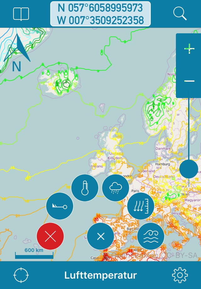
OpenSeaMap is a worldwide Opensource-project for creating a free nautical chart. Founded in 2009 the project gained a lot of attention lately adding more and more nautical information for free. Not even lights and other nautical infos are provided, but also more and more info layers like weather data, information about harbours and so on. As an add on to the OpenStreetMap this provides all missing info for nautical activities. OpenSeaMap is part of OpenStreetMap and uses the same database.
FEATURES:
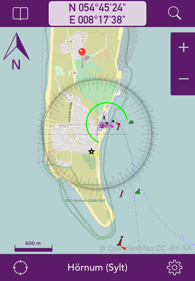
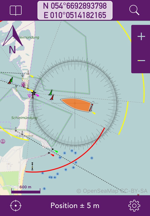
- Free worldwide sea chart (incl. HD chart graphics)
- Search for geolocations worldwide
- Chartplotting with continuous tracking
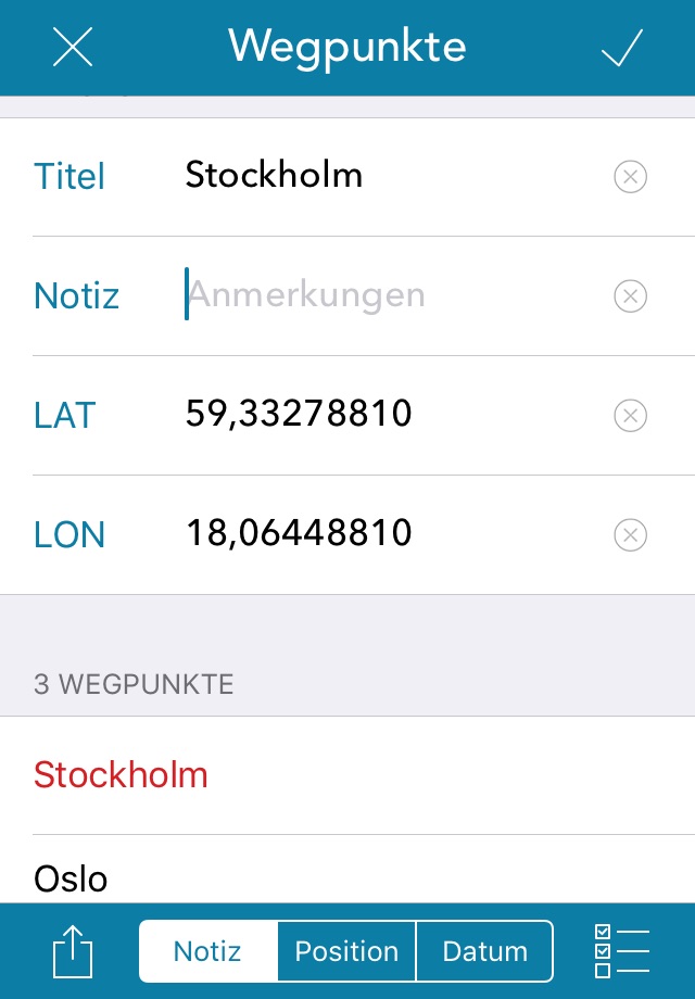
- Waypoints can easily be created, edited, deleted & exported
- Mark locations in the chart
- Zoom chart optically to fit your preferred reading size
- Enter coordinates directly to be displayed in the chart
- Offline caching of up to 1 million map tiles
- Cleanup of chart cache data at any time
+++ NEWS +++ NEWS +++ NEWS +++ NEWS +++
OpenSeaMap app now comes with new In-App-Product "PRO"
this product activates professional features if bought.
NEWS +++ NEWS +++ NEWS +++ NEWS +++ NEWS
To ensure future development and support of the OpenSeaMap app we encourage you to buy the In-App-Product "PRO". This will help keeping new updates and features coming.
DISCLAIMER: OpenSeaMap is part of the OpenStreetMap and uses the same database. As an experienced navigator you should NEVER rely your descisions on one source of information alone. Please keep in mind that the OpenSeaMap can not replace official sea charts on bord of your boat. Please use the OpenSeaMap app only in conjunction with official sea charts and conforming to national and international regulations. Please recognize that no depth information is provided by this product.
IMPORTANT: The continued use of the GPS can significantly decrease the battery level.
LICENSE: This app uses icons from the library http://icons8.com/ we thank for providing these under Creative Commons Attribution-NoDerivs 3.0 Unported License.
Latest reviews of OpenSeaMap app for iPhone and iPad
I suppose we have to buy charts to see any detail and if Im going to do that, might as well use Garmin. Views are slow and buggy to load when you zoom.
I cannot upgrade to the Professional version without any good reason...Please update the version: it doesnt work anymore. Since the last update It shows corrupted maps, zoom is blocked and no updates about wind and conditions. Please update.
This is the best I can find for an app thats free and usable. But unfortunately for what I need, it just need a little more. All I hope for is that i can bookmark an location and be able to remove them individually. This app cant even do that. I wish there is that feature, then would at least be a 4 star.
This app provides attractive maps, but I cannot get it to display the depth of the water. Nice land map, but useless on the water.
I just purchase the plot seamap and it dose not work! I wold like a refund please. You guys need to work on this before you sell this app any more.